


La palud Bastidon

pidjam
User
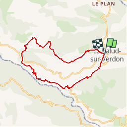

Length
15.4 km

Max alt
1388 m

Uphill gradient
881 m
Km-Effort
27 km

Min alt
706 m

Downhill gradient
882 m
Boucle
Yes
Creation date :
2017-08-30 00:00:00.0
Updated on :
2017-08-30 00:00:00.0
6h04
Difficulty : Difficult

FREE GPS app for hiking
 SityTrail
IGN / Geographical institutes
SityTrail Plus
The world is yours!
About
Trail Walking of 15.4 km to be discovered at Provence-Alpes-Côte d'Azur, Alpes-de-Haute-Provence, La Palud-sur-Verdon. This trail is proposed by pidjam.
Description
GR et PR pour un tour sur le grand canyon du Verdon.(1136m dénivelé, 15.4km)
Positioning
Country:
France
Region :
Provence-Alpes-Côte d'Azur
Department/Province :
Alpes-de-Haute-Provence
Municipality :
La Palud-sur-Verdon
Location:
Unknown
Start:(Dec)
Start:(UTM)
285913 ; 4850854 (32T) N.
Comments